Vau i Dejës (Bashkia Vau i Dejës)
Vau i Dejës, English: Deja's Ford, is a town and a municipality in Shkodër County, northwestern Albania. It was formed at the 2015 local government reform by the merger of the former municipalities Bushat, Hajmel, Shllak, Temal, Vau i Dejës, and Vig-Mnelë, that became municipal units. The seat of the municipality is the town Vau i Dejës. The total population is 30,438 (2011 census), in a total area of 499.35 km2. The population of the former municipality at the 2011 census was 8,117.
Vau i Dejës (or Vau Dejës or Vau-Dejës) also refers to the city center for the municipality, which is sometimes referred to as Laç or Laç-Vau i Dejës. Located in the northern region of Zadrima, Vau i Dejës is intersected by the Drin and Gjadër rivers. It is also strategically about 41 kilometres from the Adriatic Sea. Settlements in the area can be dated back to the 15th century, while the main city of Vau i Dejës was developed to house workers during the construction of the Vau i Dejës hydroelectric dam from 1971- 73. After the completion of the dam, families displaced from the floodwaters began to inhabit the city. Today Vau i Dejës is composed of 8 villages and a city center. The population in 2008 was 12,345. The municipality covers a total of 31 km and is composed of 1 city center and 8 villages. The villages of Vau i Dejës are Mjedë, Spathar, Shelqet, Kacë, Narac, Dush, Gomsiqe and Karmë. It is the seat of the Roman Catholic Diocese of Sapë.
The history of Vau i Dejës dates back to the old city center Deja (also known as Danja), established around the year 1127. Deja, an Albanian medieval town, was built at the point where the Drin River leaves the highlands. Deja was a strategic area because it was the crossing point of ancient roads connecting the east and the west. From Lissus, an old Roman road travelled through Nenshat and Hajmel, passing through Laç at the "Stone Pass" and continuing on to Gomsiqe and Pukë. The city was a customs point for merchant caravans passing through.
From the early thirteenth century, the feudal lords remained under Serbian rule. It was attacked during the Mongol invasion of 1242. Here was enacted Zaharia feudal family. After the formation of the principality of Balsha, Deja became part of it. In 1396, George Balsha II passed the city to Republic of Venice. In the years 1423-1443, Deja passed twice over to the Ottomans in 1443 to be released after the general anti-Ottoman insurrection. Possession of Deja was contested between feudal lords Lekë Zaharia and Nicholas Dukagjini in 1445. After the assassination of the latter, the city was returned by his mother to Venice. Skanderbeg claimed the area to be delivered to League of Lezhë, which caused the fight between Albanians and Venetians. Skanderbeg besieged the fortress in 1447-1448 but did not succeed in taking it. The city remained under Venice until 1479 when the Ottomans recaptured it.
The ruins of St. Mark's castle and the church, which dates back to the early 15th century, are still present today. According to historians, each year in this area a big fair was organized and attended by the inhabitants of the Zadrima region. This fair took place on the 25th of April and continued late hours of the morning. Agricultural goods, livestock and primitive tools that could not be found any other day of the year were available for sale.
Map - Vau i Dejës (Bashkia Vau i Dejës)
Map


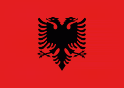
Country - Albania
 |
 |
| Flag of Albania | |
Albania has been inhabited by different civilisations over time, such as the Illyrians, Thracians, Ancient Greeks, Romans, Byzantines, Venetians, and Ottomans. The Albanians established the autonomous Principality of Arbër in the 12th century. The Kingdom of Albania and Principality of Albania formed between the 13th and 14th centuries. Prior to the Ottoman conquest of Albania in the 15th century, the Albanian resistance to Ottoman expansion into Europe led by Skanderbeg won them acclaim over most of Europe. Albania remained under Ottoman rule for nearly five centuries, during which many Albanians (known as Arnauts) attained high-ranking offices in the empire, especially in the Southern Balkans and Egypt. Between the 18th and 19th centuries, cultural developments, widely attributed to Albanians having gathered both spiritual and intellectual strength, conclusively led to the Albanian Renaissance. After the defeat of the Ottomans in the Balkan Wars, the modern nation state of Albania declared independence in 1912. In the 20th century, the Kingdom of Albania was invaded by Italy, which formed Greater Albania before becoming a protectorate of Nazi Germany. Enver Hoxha formed the People's Socialist Republic of Albania after World War II, modeled under the terms of Hoxhaism. The Revolutions of 1991 concluded the fall of communism in Albania and eventually the establishment of the current Republic of Albania.
Currency / Language
| ISO | Currency | Symbol | Significant figures |
|---|---|---|---|
| ALL | Albanian lek | L | 2 |
| ISO | Language |
|---|---|
| SQ | Albanian language |
| EL | Greek language |